-
 2026-07-18 21:04
Leader of the Revolution:
US president’s signature is worthless and invalid
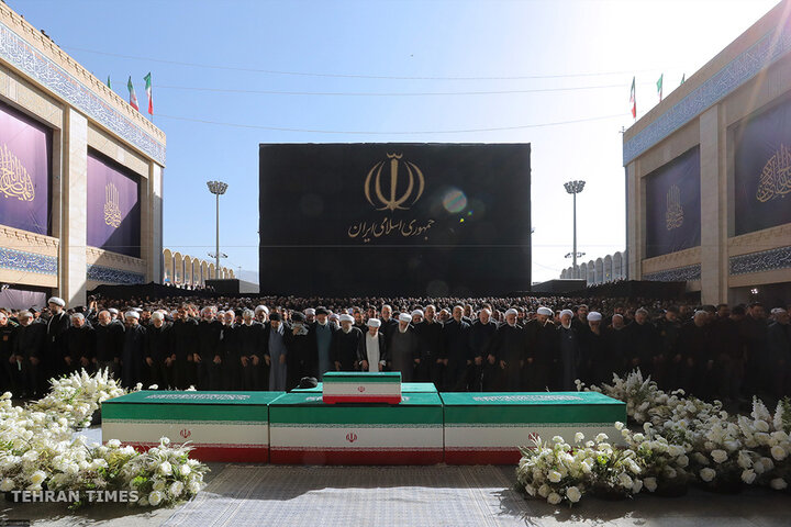
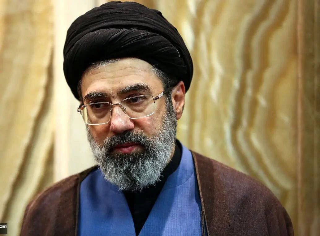
TEHRAN – New Leader of the Islamic Revolution Ayatollah Seyyed Mojtaba Khamenei issued a statement on Saturday saying that the United States' violation of a bilateral understanding with Tehran has once again demonstrated that the U.S. president's signature is "worthless and unreliable," while urging Iranians to preserve national unity and maintain confidence in state institutions.
-
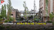
Iran hits US positions in response to raids on civilian facilities
TEHRAN — Iran on Saturday reported a series of missile and drone operations against US military facilities across the region, as the US military is targeting civilian infrastructure in Iran’s southern coastal provinces.
-
Pezeshkian calls for strengthening Iran's legal deterrence on global stage
TEHRAN - President Masoud Pezeshkian has described a systematic examination of the legal and judicial dimensions of the Israeli and US military aggression against Iran as an undeniable necessity to establish international deterrence.
-
Leader’s military advisor: Iran will shift to full-scale war if US strikes continue
TEHRAN – A senior military advisor to the Leader of the Islamic Revolution has declared that Washington’s duplicitous strategy of "both war and negotiation" has reached its final dead end, warning that Iran is fully prepared to transition into an aggressive and destructive phase if American aggression does not immediately cease.
-

By Syeda Farheen Naqi Mossavi
The illusion of victory: Why America cannot bomb its way out of the war
HAFIZABAD, Pakistan - The American people were never asked if they wanted the war against Iran. They never heard a single speech explaining why their sons and daughters must fight and die in the Persian Gulf.
-

By Behnam Molayee
Trump’s regional agenda to serve Israel
TEHRAN – The United States appears to be coordinating with some countries to rearrange the regional landscape by applying pressure on Syria, Lebanon and Iraq to serve Israeli interests.
Politics
-
Washington's moral credibility is crumbling, says Iran
TEHRAN – Iranian Foreign Ministry spokesman Esmaeil Baqaei has accused the United States of deliberately targeting civilian infrastructure during its ongoing military campaign against Iran, saying Washington's actions have undermined its claims of defending international law and combating terrorism.
-

Iran halts MoU commitments over US violations
TEHRAN – Iran has suspended all of its commitments under the Islamabad Memorandum of Understanding (MoU), declaring that Washington’s persistent acts of military aggression have effectively trampled on and halted the bilateral diplomatic framework.
-
Iran vows relentless legal action over US and Israeli crimes
TEHRAN — The Iranian Judiciary has launched comprehensive legal proceedings against the United States and Israel, seeking international prosecution and financial reparations for war crimes and military aggression against the country.
Sports
-

Iran crowned champions of 2026 AVC U18 Volleyball Championship
TEHRAN – Iran defeated Japan 3-2 (23-25, 25-22, 25-17, 25-22) on Saturday to win the AVC Boys' U18 Volleyball Championship for the eighth time.
-
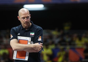
Roberto Piazza: we need to learn how to finish sets
TEHRAN - Iran national volleyball team head coach Roberto Piazza admitted his side paid the price for the energy spent in the previous match, following a straight-sets defeat to Slovenia.
-
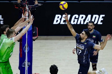
Iran fall to Slovenia at 2026 VNL Week 3
TEHRAN - Iran lost to Slovenia 3-0 (27-25, 25-19, 26-24) in Week 3 of the 2026 Volleyball Nations League (VNL) Friday night.
Culture
-
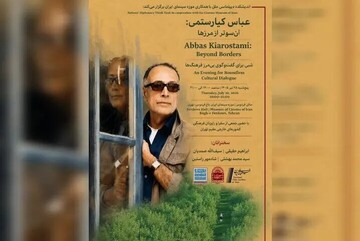
Kiarostami commemoration highlights art diplomacy as tool for international relations
TEHRAN- A special commemoration event honoring the late master filmmaker Abbas Kiarostami, titled "Abbas Kiarostami: Beyond Borders," was held on Thursday at the Cinema Museum of Iran.
-
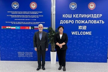
Iran, Kyrgyzstan keen on developing cultural, artistic cooperation
TEHRAN – The Minister of Culture and Islamic Guidance Seyyed Abbas Salehi arrived at Bishkek Airport on Thursday, July 16, to attend the 23rd Meeting of Ministers of Culture of the Shanghai Cooperation Organization (SCO) Member States.
-
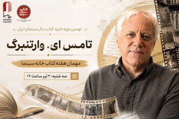
Philosophy professor to lecture at Iranian House of Cinema Book Week
TEHRAN – Thomas E. Wartenberg, a professor emeritus of philosophy at Mount Holyoke College, Massachusetts, will be one of the speakers at the Iranian House of Cinema Book Week.
Economy
-
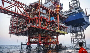
Most complex overhaul of South Pars platforms underway
TEHRAN- As the annual overhaul season begins at the shared South Pars gas field, planning is underway to maintain stable gas production. Following damage to several domestic gas refineries during recent conflicts, ensuring maximum readiness of South Pars platforms for this winter has become more critical than ever.
-
Caspian port can offset pressures on southern Iranian ports: official
TEHRAN-The CEO of the Anzali Free Zone Organization has announced a significant 58% growth in loading and unloading operations at Iran's Caspian Port, emphasizing that the development of this northern port is crucial for securing essential commodities and enhancing the country's transit capacity.
-
‘TPO puts emphasis on development of regional trade, export’
TEHRAN- The Deputy of Commercial Services at the Trade Promotion Organization (TPO) of Iran described the signing of the protocol for regional connectivity and transit facilitation between the Iran, Afghanistan, and Tajikistan as an effective step in developing regional trade, increasing non-oil exports, and strengthening Iran's position in regional transit corridors.
Society
-

ANF Summit: Iran puts forward proposals to foster regional co-op
TEHRAN – Iran has offered three proposals to expand regional cooperation in advanced technologies, human capital development, and international standardization at the Asia Nano Forum (ANF) Summit, held in Hsinchu, Taiwan, on July 16 and 17.
-
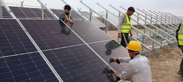
Refugees benefiting from UNIDO solar projects in Torbat-e Jam
TEHRAN – Funded by the Government of the Republic of Korea and in partnership with the Center for Aliens and Foreign Immigrants Affairs (CAFIA), the United Nations Industrial Development Organization (UNIDO) implemented a project in Torbat-e Jam settlement, expanding its solar energy capacity, creating economic, environmental and social benefits for both Afghan refugees and the surrounding host community.
-
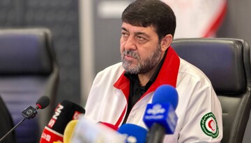
IRCS urges intl. community to hold US accountable for targeting civilian facilities
TEHRAN – The head of the Iranian Red Crescent Society, Pirhossein Kolivand, has condemned the recent US attacks on the country’s civilian facilities and infrastructure, urging the international community to conduct prompt, independent, impartial, and effective investigations to hold perpetrators accountable for their war crimes.
Tourism
-
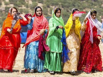
Traditional clothing of Chaharmahal-Bakhtiari: A rainbow of ethnic heritage
The traditional clothing of Chaharmahal-Bakhtiari is among the most distinctive expressions of Iran's cultural heritage. Characterized by vibrant shades of pink, green, red, orange, purple, blue, yellow, and white, these garments form a living rainbow that reflects centuries of artistry, craftsmanship, and ethnic diversity.
-
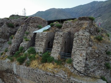
Research suggests Alamut Castle's role extended beyond military functions
TEHRAN – The ancient Alamut Castle [and its satellite forts and defensive structures], long known primarily as a political and military stronghold of the Nizari Ismaili state, may also have served as a center for preserving and producing scientific knowledge, the head of the library at the Center for Documents of the Great Islamic Encyclopedia said.
-
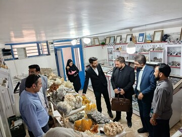
Tourism delegation from Afghanistan visits Iran’s barberry capital to expand cooperation
TEHRAN — Tourism officials in Iran’s South Khorasan province introduced the village of Afin, known as the world’s capital of seedless barberry, to tourism industry representatives from Afghanistan’s Herat and Farah provinces during a two-day familiarization tour aimed at strengthening cross-border tourism cooperation, a provincial official said on Saturday.
International
-
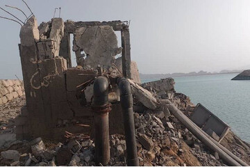
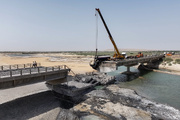
US raids on civilian infrastructure are purely barbaric
TEHRAN – The U.S. military has not only targeted military facilities in Iran’s southern coastal provinces. It has also been striking wheat silos, water desalination plants, and electricity infrastructure.
-
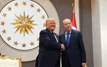
Trump’s regional agenda to serve Israel
TEHRAN – The United States appears to be coordinating with some countries to rearrange the regional landscape by applying pressure on Syria, Lebanon and Iraq to serve Israeli interests.
-

Why do Lebanese authorities insist on the path of surrender?
TEHRAN – Following the sixth round of face-to-face talks between the Lebanese and Israeli governments, critics continue to question the Lebanese authorities’ approach to issues of occupation and sovereignty.


Most Viewed
-
Relentless strikes until peace returns to the southern coast
-
Any US ground invasion would Put Kuwait, Bahrain in Iran's crosshairs: MP
-
Israel failing to repair brutal reputation among Americans
-
Why do Lebanese authorities insist on the path of surrender?
-
What happens if both Bab al‑Mandab and the Strait of Hormuz are closed?
-
Iran condemns US, Israel, and Argentina over opposition to UN anti-terrorism resolutions
-
How did a needless war become Trump's gravest economic mistake?
-
Leader’s military advisor: Iran will shift to full-scale war if US strikes continue
-
Iravani: US committing ‘heinous war crimes’ in Iran
-
Persian Garden: A masterpiece of water engineering, geometry and beauty
-
US president’s signature is worthless and invalid
-
Iran hits US positions in response to raids on civilian facilities
-
Iran committed to establishing a fair economic order in world, minister says at BRICS meeting
-
Over 80 earthquakes hit Iran in a week
-
Iran condemns US strike near children's cancer hospital, calls it a 'War Crime'