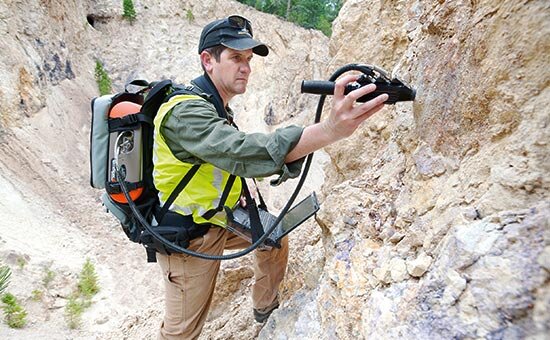
GSI to explore 110,000 km2 of land to identify new mines

TEHRAN - Geological Survey and Mineral Explorations of Iran (GSI) is planning to explore 110,000 square kilometers (km2) of land across the country in the current fiscal year (ending on March 20, 2020), in order to identify new mining potentials, IRNA reported.
According to GSI office of public relations, last year (March 2018-March 2019) over 111,720 km2 of land were explored under the framework of a program dubbed “identification and exploration of new mines”, while the goal was 110,000 km2.
Iran has heavily invested in its mining sector in order to offset the revenue losses from the oil industry due to the U.S. sanctions.
In Late June, Iranian industry, mining and trade minister announced that increasing exports from the mining sector to the neighboring countries has been put on the ministry’s agenda for the current fiscal year.
Meanwhile, head of Iranian Mines and Mining Industries Development and Renovation Organization (IMIDRO) said the organization is planning to establish a consortium in order to accelerate exploration projects in the mining sector.
“The consortium is going to help us in areas like exploration and identification of new mines and minerals,” Khodadad Gharibpour said.
According to the official, based on the mining potentials and research and academic capabilities of the country’s provinces, 10 mining regions have been defined in order to manage projects and also utilize the country’s academic potentials in this industry.
In the framework of the country’s Sixth National Five-Year Development Plan (2016-2021), efficiency, productivity and maximum utilization of the capacities of the country’s mining industry have been given great importance.
IMIDRO currently has $3 billion worth of projects underway and it also intends to renovate 5,000 industrial units using 100 trillion rials (about $2.38 billion) of investment during the current Iranian calendar year (started on March 21).
EF/MA
Leave a Comment