The geography of the strait speaks for itself
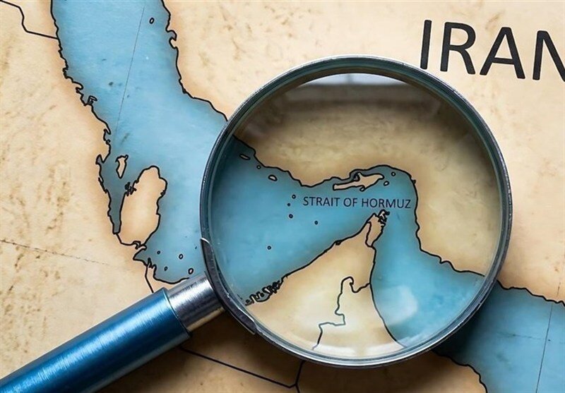
If we look at the map of the physical geography of our beloved country and carefully examine the position of the Strait of Hormuz on it, an important truth becomes evident: the Strait of Hormuz is not merely a waterway, but the natural, submerged continuation of the body of the Iranian Plateau.
Relying on two fundamental characteristics—the convexity (arc) of the coastline toward the interior of Iran and the geological extension of the seabed from the heart of the Zagros mountain range—it becomes clear that this Strait constitutes an inseparable part of the natural domain of the Iranian Plateau, and any other interpretation amounts to disregarding undeniable geographical facts.
The convexity (the northward curvature) of Iran's coastline is more than a natural phenomenon; it is a God-given geometric design embedded in geography that has made Iran's complete mastery over this chokepoint possible. The deepest—and the only navigable—channel for supertankers lies precisely adjacent to the apex of this arc and the Iranian islands of Qeshm, Larak, and Hengam. This means that, in practice, the "vital artery" of maritime traffic flows in the embrace of Iran's geography, and no country can gain access to the Persian Gulf without passing beneath the shadow of this arc.
The aforementioned arc has shaped the Strait into a concave bow, with the strategic islands of Abu Musa, Greater Tunb, Lesser Tunb, Qeshm, Larak, Hengam, and Hormuz arranged precisely along the tip of this arrow. These islands, which military experts describe as "unsinkable aircraft carriers," enjoy a 360-degree field of vision and dominance over the shipping route without the need for movement, forming the first line of defense for Iran's maritime borders.
The narrow width of the channel and the existence of shallow sedimentary areas along the edges of the arc place severe limitations on the maneuverability of foreign naval fleets. Under such circumstances, asymmetric tactics such as the "mass deployment of fast attack boats" and the "laying of naval mines" become highly effective, and Iran, relying on its complete knowledge of the seabed, holds the security of this waterway in its hands.
Furthermore, by extending its sphere of surveillance to the port of Jask, east of the Strait, the Islamic Republic of Iran has transformed this arc into a "complete crescent." As a result, the line of defense extends beyond the chokepoint itself, enabling Iran to detect any movement kilometers before vessels enter the Persian Gulf from the Sea of Oman.
Beyond all this, from a geological perspective, the Strait of Hormuz is nothing other than the submerged continuation of the Zagros mountain range and part of the body of the Iranian Plateau. The sedimentary layers and salt domes beneath the Strait correspond entirely in structure to the southern mainland of Iran and originated from the very tectonic processes that shaped the Iranian Plateau itself. Moreover, during the last Ice Age, the Persian Gulf formed part of the dry land of the Iranian Plateau, while the Strait of Hormuz was an ancient valley through which the great rivers—the Karun and the Euphrates—flowed. This historical continuity bears witness to the intrinsic belonging of this seabed to the land of Iran.
Hydrocarbon reserves also speak to this reality. The enormous oil and gas fields beneath the Strait are the natural continuation of the resources found in the southern mainland of Iran, and this economic continuity further affirms the inseparable connection of this expanse with the territory of Iran.
The convexity of the coastal arc and the geological continuation of the seabed are two sides of the same coin, making the Strait of Hormuz an inseparable part of Iran's geographical body. On the one hand, the geometry of the battlefield enables Iran to act as the "gatekeeper" of the Persian Gulf and guarantee the security of this waterway. On the other hand, the natural continuation of the Iranian Plateau beneath the sea fundamentally invalidates any claim that this expanse is separate from the motherland.
In light of these considerations, beyond what colonial powers and maritime empires have written into treaties, the Strait of Hormuz is part of Iran's geographical reality. Indeed, even raising the issue of joint management of the Strait or involving the southern littoral states in its administration runs contrary to the natural geography of the Strait itself. Almighty God created the Strait of Hormuz in such a way that it lies within the depth of the Iranian Plateau and constitutes its natural continuation. It is precisely this geographical structure that gives meaning to its political and legal reality. Relying on these undeniable geographical facts, the Islamic Republic of Iran has always emphasized its full sovereignty over this strategic chokepoint and regards any foreign interference as contrary to the natural and historical realities of the region.
Leave a Comment