Total:2
-
 2023-12-24 15:19
Third intl. Iran Geo exhibition kicks off
TEHRAN – The third international Iran Geo exhibition, which is the first exhibition of spatial information in West Asia, opened in Tehran on Saturday, December 23, and will run until December 26.
-
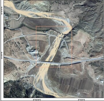 2023-11-25 15:43
"Khayyam" satellite captures images of flood-hit areas
TEHRAN – The homegrown "Khayyam" satellite has captured images from flood-hit regions in the west and southwest of the country.