Discover Ozbaki hill that goes down 9,000 years in history

TEHRAN - “Nine thousand years of history.” It’s a phrase that may seem enough to draw the attention of every history buff across the globe.
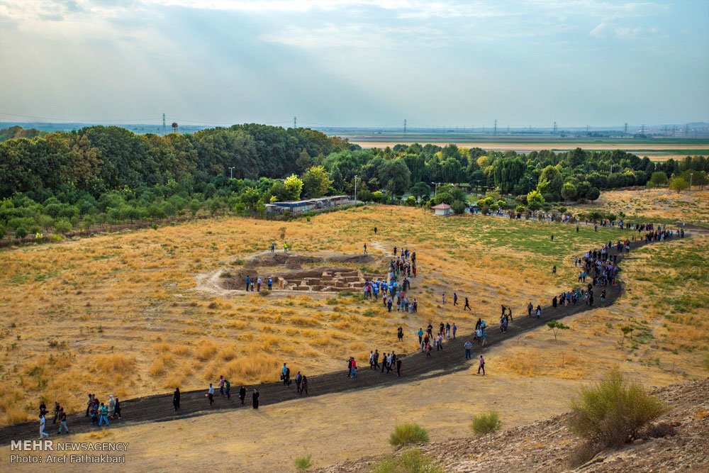
Ozbaki hill, also called Ozbaki Tappeh or Uzbaki Teppeh, is situated near Nazarabad, some 80 km west of Tehran. The site has yielded cultural relics dating from the first half of the 7th millennium to the first half of the first millennium BC, i.e. the Medes period.
“The discovery of objects such as tablets, statuettes, and ‘jagged’ earthenware in Ozbaki hill indicate some kind of commercial link between Susa in Khuzestan and this in Tehran province,” according to senior Iranian archaeologist Yousef Majidzadeh who led the excavations at Ozbaki, Qabristan and Jiroft hills.
Back in 2016, the archaeological enclosure opened to the public as an open-air museum of cultural heritage. It was announced in the same year that the archaeological enclosure is in the queue for registration in the UNESCO World Heritage list.
“The significance of the site was such that the invaders, after occupying it, chose it as their settlement and their rulers built a castle to control a major part of their territories in the central plateau,” Majidzadeh noted.
His article on the hill, which has been posted to the Circle of Ancient Iranian Studies, is given below:
With a longitude of 50.34 and a latitude of 35.54, the historical site of Ozbaki is situated 15 km southwest of the Old Town of Hashtgerd in Savojbolagh region, some 73 km to the west of Tehran. The altitude of the Ozbaki village from the sea level is 1118 meters. It is a vast ancient site, comprised of some short mounds and a high mound standing 26 meters above the surrounding lands.
Some of the mounds, according to residents are: Kumush Tappeh, located 400 meters to the west of the tall mound known as Ozbaki Tappeh, Jairan Tappeh located 250 meters to the south of Ozbaki Tappeh, and Yan Tappeh, located at some 700 meters to the southwest of Ozbaki Tappeh. The archeology team named three other mounds as Doshan Tappeh, Maral Tappeh and Takhtgah Tappeh. Considering the depth of ancient layers of soil down to unscathed soil proven in the northern side of Ozbaki Tappeh, its altitude from intact earth is more than 30 meters.
Considering the scattered form of the mounds and according to earthenware findings, it can be said that the area of Ozbaki site is about 100 acres. Before excavations at Ozbaki Tappeh, the oldest sites so far found in the central Iranian Plateau were only found in the Silk Tappeh near Kashan and Zagheh Tappeh in the Qazvin Plain. These relics have been identified in the Ozbaki site, at Yan Tappeh, in the form of a small village covering an approximate area of one acre. In this small, pillow-shaped mound of which 200 square meters have so far been excavated, relics of five periods of clay brick architecture have been identified, dating back to two cultural eras in the seventh and sixth millenniums BC.
In all of the five periods, the bricks are handmade, the oldest of them being the most ancient type of bricks found in archeological excavations in the whole Middle East.
The average area of buildings in this site is 2.5 to 3.5 square meters, and in some cases larger. Although no trace of roofs have so far been found from these architectural remains, their excessive smallness indicates that they were covered with primitive material such as tree branches and leaves and possibly a layer of cob. Inhabitants of this settlement buried their dead on the floor of their dwellings and covered the floor with bricks.

The expanse of the settlements of these people, whose relics have been found in recent decades all throughout the Central Plateau does not exceed a few acres, in which the potters created the most beautiful earthenware of their times. However, in Ozbaki Tappeh these remains have been found across an area covering 400X800 meters(i.e. 30 acres) from the excavated layers, which are unique in their ago.
Simultaneous with the second period in Silk, the inhabitants of Yan Tappeh abandoned their settlements for unknown reasons, moving to site some 100 meters to the west of high mound of Ozbaki hill.
Until the 1970s, our knowledge of the chronicle of prehistoric cultures in the Central Plateau was based on the results of French excavations in Kashan's Silk mound. According to this chronology, since the most ancient times up to the mid 4th millennium, BC the societies of these regions belonged to the same culture, one which continued during the above millennia continuously.
However, in the early 1970s, excavations led by this author in the Qabrestan Tappeh in the Qazvin plain revealed new findings in the form of different earthenware. In excavations in Ozbaki Tappeh we found similar remains of earthenware called Plum Ceramics because of their color. Coherent architectural remains belonging to this culture were also found, leaving no doubt about the invasion of migrating intruders, confirming social and political changes in this part of land of Iran. Although there is still no concrete evidence of the origin of the invaders, it sees that their original homeland was a region beyond the Caucus Mountains.
Furthermore, a minute study of the prehistoric earthenware of the Central Plateau shows that the differences between these periods are so considerable that each kind of pot represents a different ethnic group, indicating the movements of different ethnic groups in the Central Plateau. Doubtlessly future studies on human bone findings, particularly DNA tests will answer such questions.
The Plum Ceramic culture disappeared after a few centuries, replaced by another earthenware culture known in Silk Mound as the Third Period, ending with the start of the script era in Mesopotamia mid 4th millennium BC.
The discovery of objects such as tablets, statuettes, and "jagged" earthenware in Ozbaki Tappeh indicate some kind of commercial link between Susa in Khuzestan and this are in Tehran province.

Evidence found about the migration and presence of "Grey earthenware' Aryans particularly in the east and center of the Iranian Plateau up to the Medes kingdom is chiefly comprised of graves and cemeteries, therefore the general assumption is that the early Aryans were camp dwellers.
However, in the Ozbaki site the evidence found shows that after the arrival of the "Grey earthenware" Aryans in Iran in the second half of the 2nd millennium BC, this site turned into a large city, because the remains of their earthenware are scattered across an area measuring 1X1 km, and in the center of it, on top of ancient remains on the high mound of Ozbaki a castle was built covering around 2,200 square meters with a huge wall 7 meters wide, of which 3 meters of the height still remain. On the remains of this castle and before the Medes kingdom, two other castles were built, one on top of the remains of the other. The Medes finally built a fourth castle covering 900 square meters, three fourth of whose buildings have already been excavated.
Such a deployment of migrating Aryans in the Ozbaki site undoubtedly indicates its significance in prehistoric times, and shows that this site was possibly the largest and most important political and economic center, and in other words the heart of the cultures of the Central Plateau.
The significance of the site was such that the invaders, after occupying it, chose it as their settlement and their rulers built a castle to control a major part of their territories in the central plateau. The graveyard belonging to those people has been identified some 250 meters from the Doshan Tappeh buildings.
AFM/MG
Leave a Comment